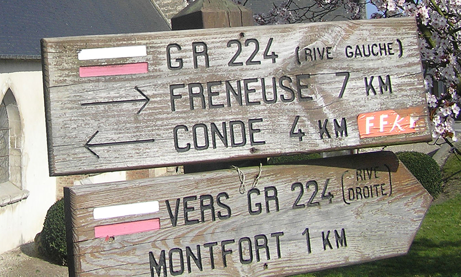
Discovery of the long-distance hiking trails (GR) of Normandy
The long-distance hiking trails of France
In France, the Grandes Randonnées (GR) trails represent a network of marked hiking paths designed for both casual and experienced hikers. These trails traverse regions throughout the country, offering hikers the opportunity to discover the richness and diversity of French landscapes. Each GR trail is unique, winding through varied terrain such as mountains, forests, valleys, and coastlines, and offering routes ranging from a few days to several weeks. These paths are marked with distinctive signs, often white and red stripes, ensuring easy and safe navigation for hikers of all levels.
The Normandy section of the GR223 trail
The GR223 hiking trail, located in Lower Normandy, offers a route along the Normandy coast, from the Seine estuary at Honfleur to Mont Saint-Michel. This trail spans over 400 kilometers, crossing the Cotentin and Bessin Marshes Regional Natural Park, revealing remarkable natural sites and historic Norman ports such as Cherbourg. The GR223 offers a diverse hiking experience, combining wild maritime landscapes with coastal paths, including former customs officer trails. Divided into 18 stages, this hike can be completed in less than a month, although it requires special attention during periods of heavy rainfall and high tides. Be aware of some elevation changes during your hike. Make sure to equip yourself with suitable footwear.
The GR34: A Journey Along the Emerald Coast
The GR34 begins in Vitré and extends to Mont Saint-Michel, skirting the bay towards Cancale. This trail rarely strays far from the coastline, thus exposing the magnificent Emerald Coast. Progressing towards Saint-Brieuc, hikers encounter the Goëlo Coast, followed by the famous Pink Granite Coast between Lannion, Guingamp, and Morlaix. This coastal route, also known as the “customs officer’s path,” is punctuated by impressive cliffs and sandy beaches. The GR34 offers a unique perspective on the diversity and beauty of French maritime landscapes.
Practical Advice and Preparations
To undertake these hikes, it is essential to prepare adequately. Hikers should equip themselves with clothing suitable for variable weather conditions, sturdy hiking shoes, and sufficient provisions of water and food. It is also advisable to plan the stages according to experience and physical condition. Additionally, checking tide times and weather conditions in advance is recommended to ensure a safe and enjoyable hiking experience.